Basalt Canyon - a Tale of Many Bridges
Text and photos By Lydia Aisenberg
Although called the Harod Stream, this body of water twists and turns over a distance of 32 kilometers, far outliving the title 'stream' in many places, especially in the winter months such as after the recent and presently on-going heavy rainfall in Israel.
Known as Nahal Harod in Hebrew, the Harod wends its way between dozens of palm tree surrounded fishponds and lush agricultural lands farmed by the members of kibbutzim and moshavim situated in the eastern part of the Jezreel Valley.
The Harod eventually flows from this region, daubed the 'Valley of Springs' because of the area's plethora of small and large springs and babbling brooks, into the famous but much depleted over the years river running through the nearby Jordan Valley, the biblically lauded River Jordan.
An abundance of large and small user friendly facilities around the natural watering holes, caringly, tastefully designed to blend in with nature, have been developed by the Israel National Parks Authority and Keren Kayemet L'Israel (Jewish National Fund) attracting hundreds of thousands of visitors throughout the year.
During the summer one can find scores of picnicking families, children happily splashing in a nearby natural pool, throughout the region whilst above on trails developed along the ridges of the Gilboa mountain range, bikers, hikers and cross country runners enjoy miles of challenging terrain full of thick natural growth as well as an abundance of afforested areas.
As autumn runs into winter, folks come to the area to walk one of the hundreds of well-marked and family friendly developed trails stretching for miles, some of which taking one close to the banks of the Harod stream where dense waterside greenery and bamboo shoots cover large areas, and from the higher places, breathtaking views afforded over the Jezreel Valley and across the Jordan Valley to the slopes of the Gilead mountain range where many Jordanian villages and army bases are situated and clearly visible most winter days.
However, that particularly glorious sight is often shrouded by heat hazes during the relentlessly hot summers.
Recently, after a period of heavy rain and on a warm sunny winter's day, this writer and family hiked a trail known as the Harod Stream Bet Shean National Park Bridges Trail, beginning east of the ruins of the ancient city of Bet Shean and close to the town's present day railway station.
The well-marked and well-trodden trail wends its way in unison with the Harod stream, the sounds of water rushing down the hillside between the flora and thick vegetation filling the air, heard before seen. Flocks of birds, large and small, fly overhead on their way to warmer climates – no doubt to retrace their flight paths back to Europe in spring.
The Harod watershed begins 180 meters above sea level and by the time it ends up in the Jordan River has dropped to 280 meters below, boosted along the way by drainage water from the valley's fishponds, fields and winter rain runoff.
Over the 32 kilometer route to the Jordan River, one can find the remains of many Roman and Ottoman period built flour mills and bridges. On the Bet Shean Bridges Trail beginning in Bet Shean, remains of majestic arches - big and small – turn into Mother Nature's Gilead Mountain range in the Hashemite Kingdom of Jordan, a country that took its name from the river.
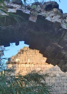
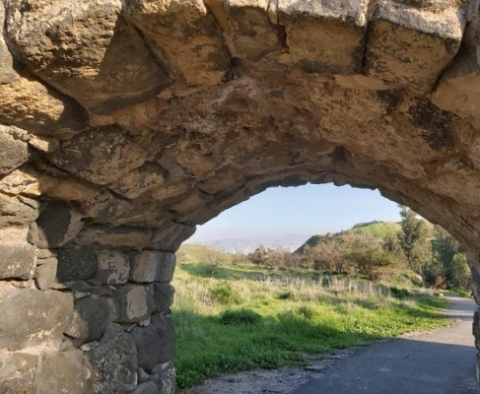
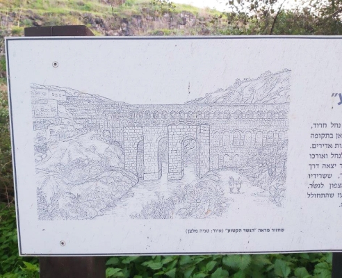
One of the largest of the ancient bridges, eventually destroyed by an earthquake, can be found over the Harod on the Bridges Trail. Huge, almost complete and partial remains of the bridges 14-meter-high arches, and length of 37 meters spanning the riverbed, testifies to the importance of Bet Shean and the region to the Romans. A nearby board with a drawn illustration of how the bridge would have looked in the Roman's glory days alongside the ruins shows just how impressive the original bridge would have been.
In the vicinity of the bridge, although closed to the general public at the moment, are the remains of a monastery, the Kyrie Maria, built in 567C.E. and named after its affluent patron-donor. The monastery was destroyed in 636 C.E. at the start of the ancient Islamic era.
Known for its exceptional mosaic floors, the main one of which includes a circle inside a fortune wheel bearing shapes of the sun and moon inside and even bigger circle divided into 12 sections – each depicting a month of the year. The fortune wheel is surrounded by additional paintings of water birds, peacocks, fish and other animals and in another of the rooms, is a floor depicting various harvesting chores.
The lower section of the Nahal Harod Bet Shean Bridges trail brings hikers to a steep, but very deep, narrow basalt canyon and amazing foam spewing waterfalls, the turbulent waters having passed under an Ottoman bridge that unbelievably was used by local traffic up until the mid-1990s.
In present times a steel suspension bridge links the two sides of the canyon at this point, providing not only a wonderful view over one of the series of waterfalls but also over the area in general, one of great importance and popularity with birdwatchers.
A footpath leads to the Bet Shean birdwatching area on one side of the basalt canyon and suspension bridge and on the other, a welcome KKL rest and recreation area – where a flock of patient birds seem to be waiting atop nearby trees for the visiting hikers to drop a few crumbs under the benches and picnic tables.


Comments